Roche Miette
Roche Miette Stats
28 August 2005
Climb for the Alberta Centennial Mountain Expedition (mountain #78) with Erin, Trevor, Marc, Hank. I am just going to poach the text that I sent the ACME for this trip. See their website for more pictures (very big and long to load).
Roche Miette, Climbed 28 August 2005 on Behalf of the Alberta Centennial Mountain Expedition.
When I first discovered the Alberta Centennial Mountain Expedition I was quite excited to volunteer for the project. Soon though, I received an email from Angus and Melany that dashed my aspirations. They had already assigned all of the mountains to other climbers. I had been placed on the backup list and resigned myself to the fact that I had missed the boat.
On the 8th of August 2005 I received a phone call from Angus. The original group assigned to Roche Miette was unable to get to the summit, so now I had my opportunity to participate. I put together a group of five that included my younger sister and some good friends. All of which had some scrambling and backcountry experience.
We planned to make our climb on the 28th of August. During the preceding week we carefully watched the weather, willing it to hold long enough so we could climb without worrying about storms.
At 3:30 AM on the 28th we left St. Albert and drove out to Jasper, meeting two of our group members in Edson. We reached the trailhead under clear skies at 7:30 AM and had geared up and started walking at 8:00 AM. As we began I would estimate the temperature was about 10°C. While walking up the cut line we proceeded in and out of some curious pockets of air that were another 10°C warmer, quite an interesting sensation to say the least.
Soon our group was hiking up the ridge and gaining elevation on our way to the saddle. Once at the upper half of the ridge, we were treated to views across the Athabasca Valley. The upper half of the ridge itself sports some very intriguing vertical flakes and striking layers of purple shale. By 10:10 AM we were enjoying the sunny skies and a bite to eat at the saddle.
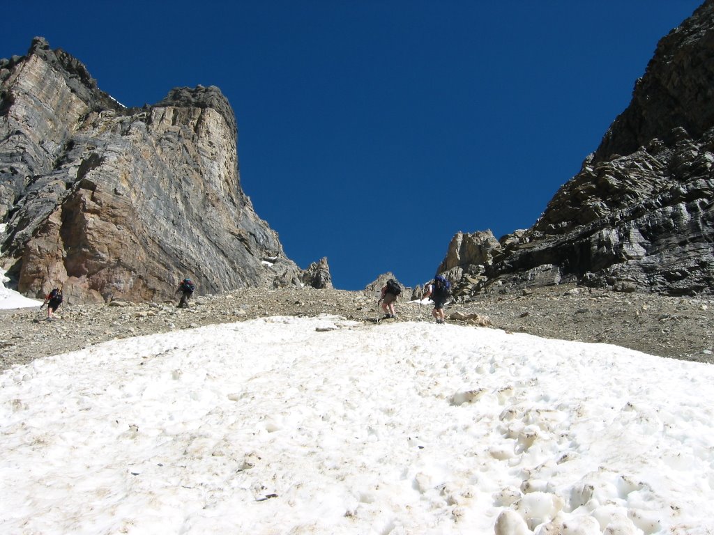
Departing the saddle, the scramble begins in earnest with movement to the climbers left as elevation is gained. Most of the scrambling is over loose rock and scree, interspersed with the odd down sloping ledge. None of it proved to be particularly challenging, but it is sustained moderate (fun) scrambling.
At 11:45 AM we topped out on the plateau and were greeted with 10 minutes of sleet generously provided by the weather we had watched build over the previous hour. Wasting little time, we walked easily over to the true summit of Roche Miette approximately 600m to the South. We were standing beside the summit cairn by 12:00 PM.
We were treated to views of the Jacques Range, Mts Hawk, Colin, Perdrix, Fryatt, Pyramid, De Smet and numerous others. Photo taking and lunch commenced while we discussed how to remove the existing summit canister secured with a cable by Alan Kane. Replacement proved easy as the cable was frayed and easily released the PVC canister. As we took the requisite 360° photos we knew that we’d need to leave the summit soon. Somewhat ominous looking weather had been closing in on us since we arrived.
At 1:00 PM our group left the summit, scrambled down the mountain, and arrived at the saddle at 2:45 PM where the weather was much nicer. We descended the ridge under partly sunny skies, spotted a whitetail deer watching us from the cut line, and reached our cars at 4:30PM.
After a number of parting glances towards the striking mountain we had just spent the day with, we began our drive home with feelings of accomplishment. Of course making the necessary stop for food at Vic’s Steak, Pizza, and Curry in Hinton.
I would like to thank Angus and the Alberta Centennial Mountain Expedition on behalf of our group for affording us the opportunity to be a part of this project.
Troy Rossmann.
Climbers: Erin Rossmann, Trevor Graham, Hank Kirouac, Marc Boudreau, Troy Rossmann.Trip Stats: 1323m elevation gain, 11.1 km, 8.5 hours round trip.

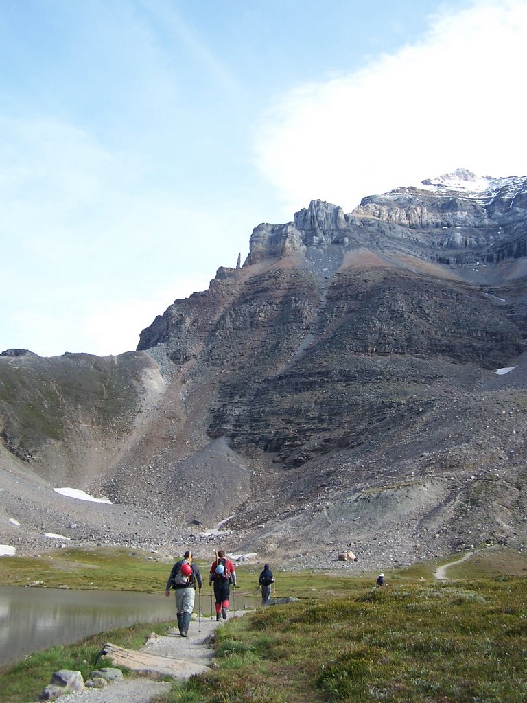
View of the mountain from the adjacent ridge.
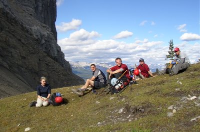
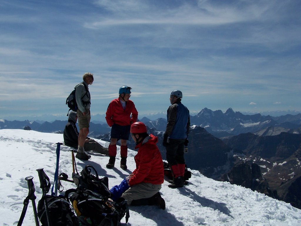
Our group takes a break at the saddle.

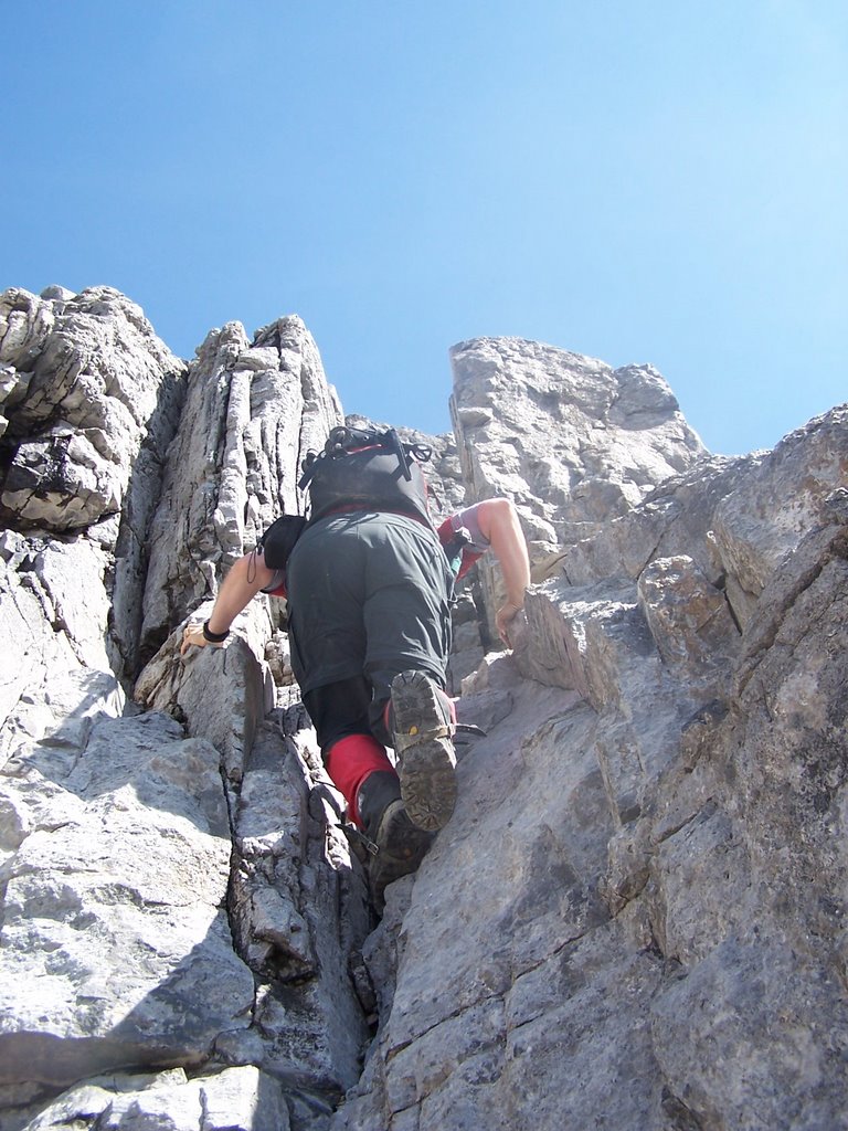
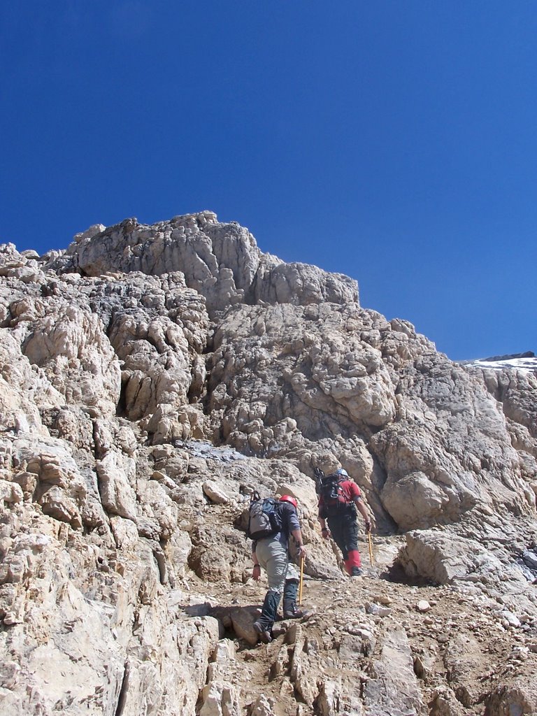
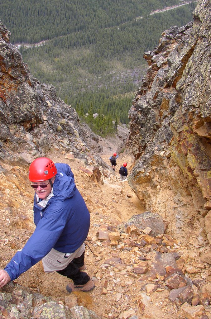
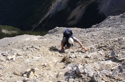
Marc negotiating typical terrain on Roche Miette.
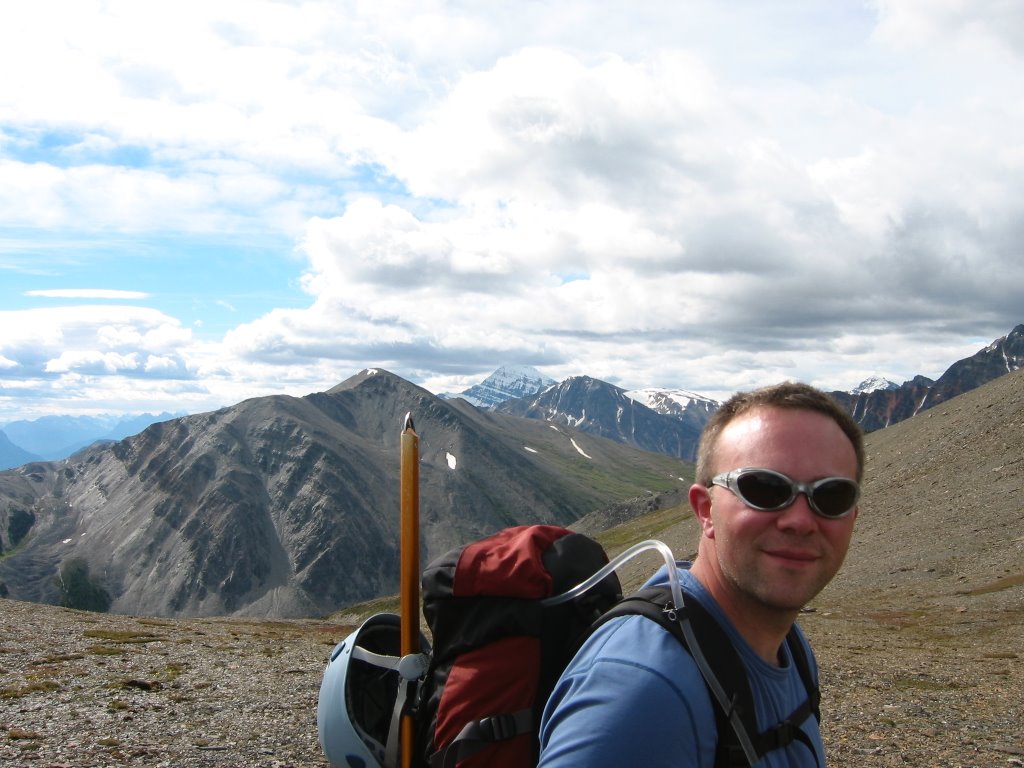
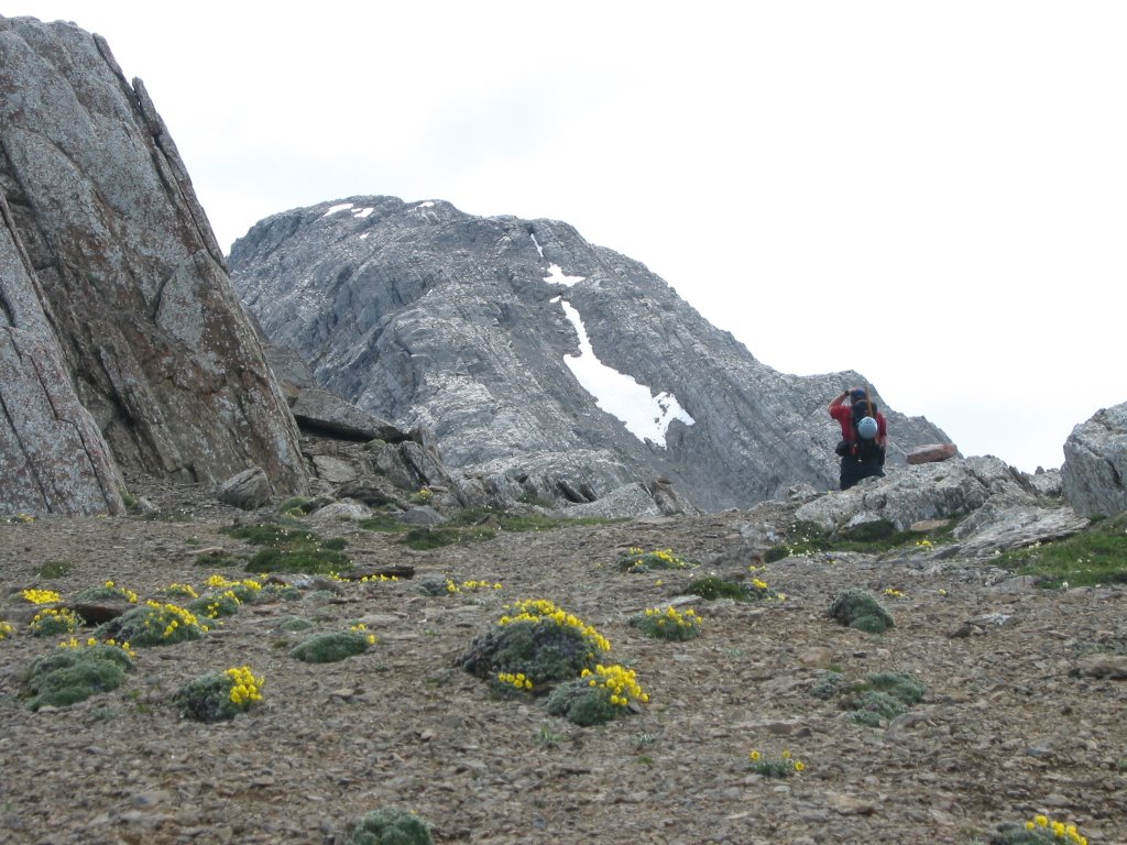
Trevor getting within striking distance of the summit plateau. This is such a hero shot.

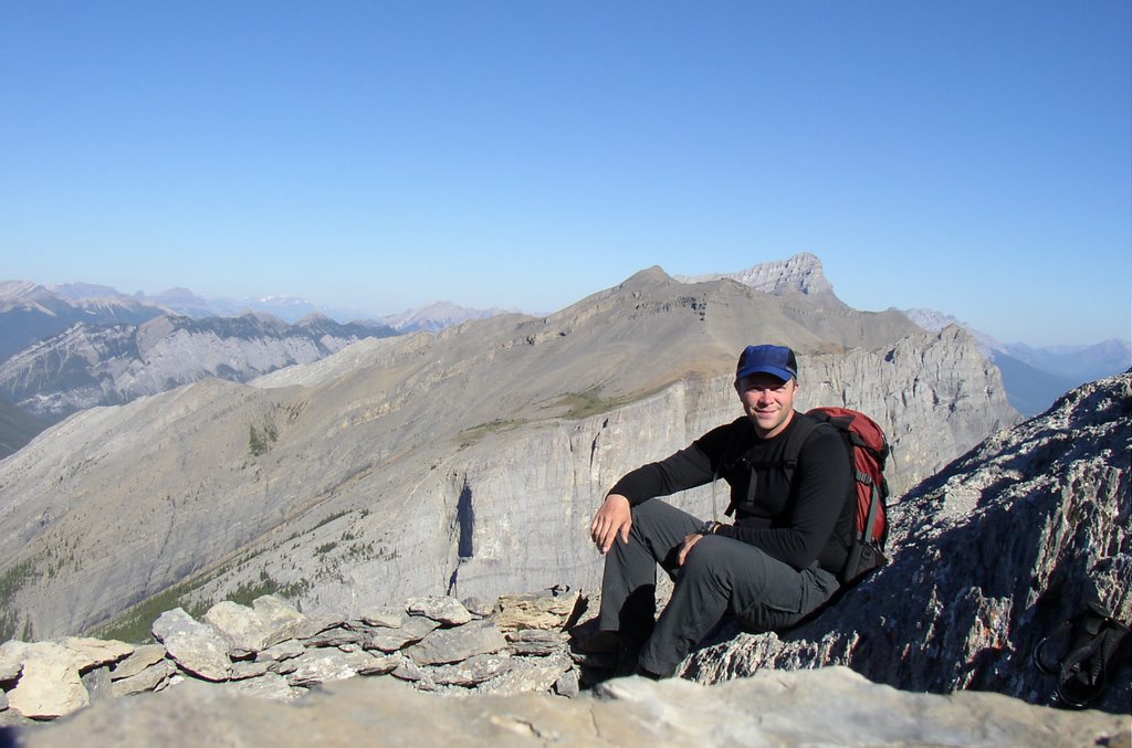
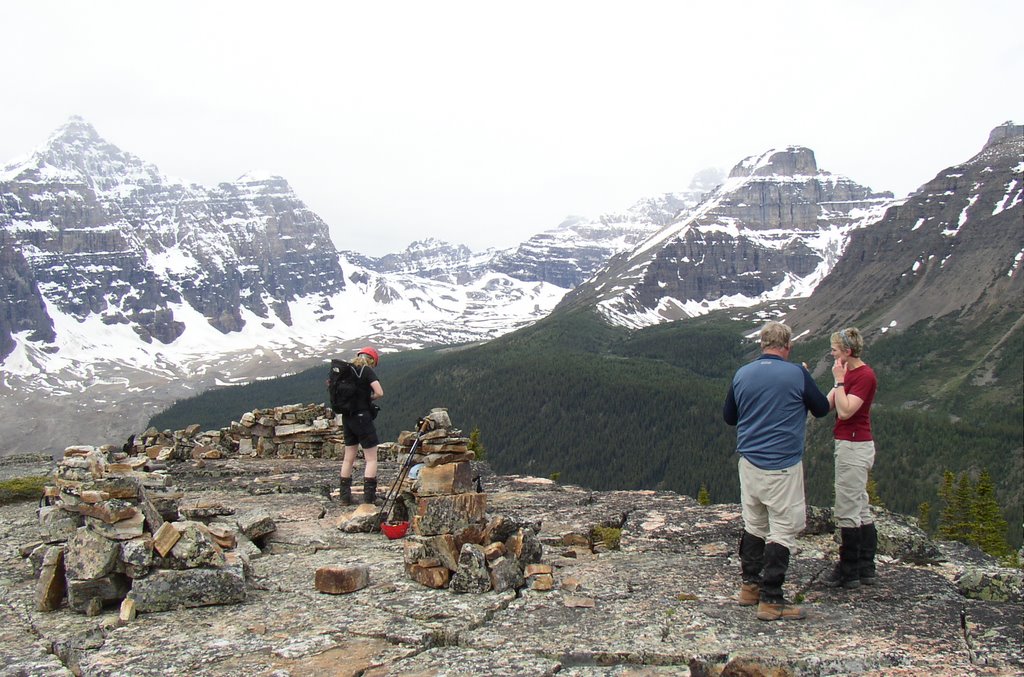
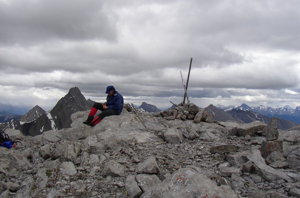
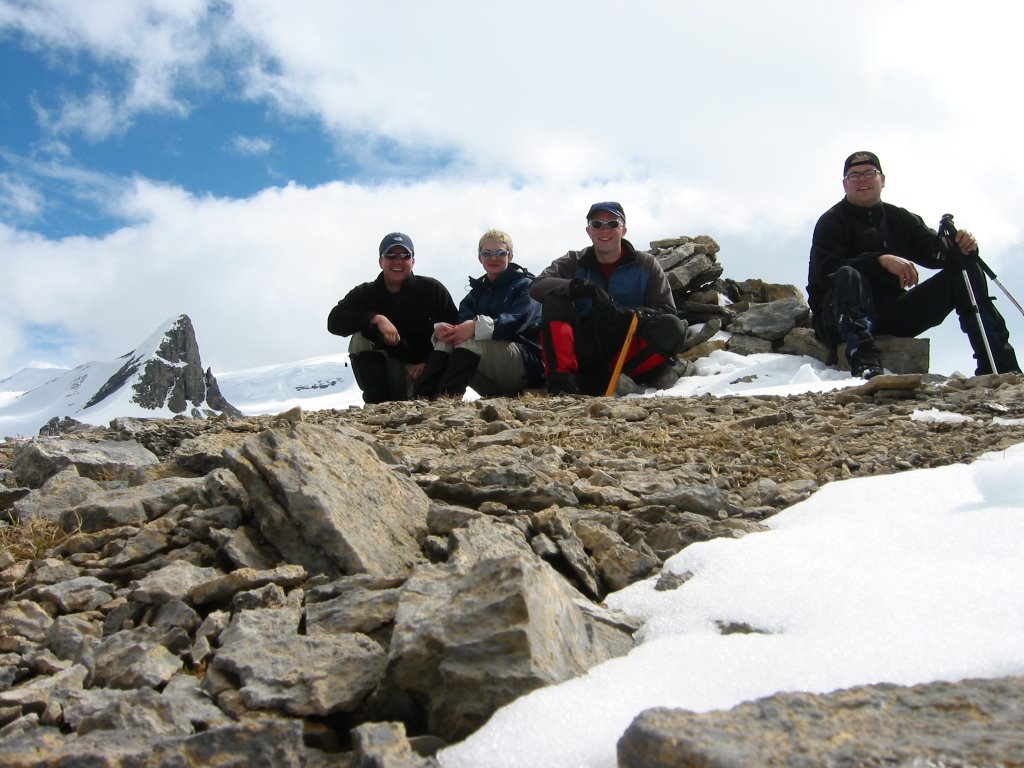
At the cairn. The true summit of this mountain is a leisurely 600m walk to the south from the point where you get onto the plateau, it is not at the top of the cliffs guarding the north face. The reason why is apparent when the mountain is viewed from the west, it's the highest spot from that vantage.
28 August 2005
Climb for the Alberta Centennial Mountain Expedition (mountain #78) with Erin, Trevor, Marc, Hank. I am just going to poach the text that I sent the ACME for this trip. See their website for more pictures (very big and long to load).
Roche Miette, Climbed 28 August 2005 on Behalf of the Alberta Centennial Mountain Expedition.
When I first discovered the Alberta Centennial Mountain Expedition I was quite excited to volunteer for the project. Soon though, I received an email from Angus and Melany that dashed my aspirations. They had already assigned all of the mountains to other climbers. I had been placed on the backup list and resigned myself to the fact that I had missed the boat.
On the 8th of August 2005 I received a phone call from Angus. The original group assigned to Roche Miette was unable to get to the summit, so now I had my opportunity to participate. I put together a group of five that included my younger sister and some good friends. All of which had some scrambling and backcountry experience.
We planned to make our climb on the 28th of August. During the preceding week we carefully watched the weather, willing it to hold long enough so we could climb without worrying about storms.
At 3:30 AM on the 28th we left St. Albert and drove out to Jasper, meeting two of our group members in Edson. We reached the trailhead under clear skies at 7:30 AM and had geared up and started walking at 8:00 AM. As we began I would estimate the temperature was about 10°C. While walking up the cut line we proceeded in and out of some curious pockets of air that were another 10°C warmer, quite an interesting sensation to say the least.
Soon our group was hiking up the ridge and gaining elevation on our way to the saddle. Once at the upper half of the ridge, we were treated to views across the Athabasca Valley. The upper half of the ridge itself sports some very intriguing vertical flakes and striking layers of purple shale. By 10:10 AM we were enjoying the sunny skies and a bite to eat at the saddle.
Departing the saddle, the scramble begins in earnest with movement to the climbers left as elevation is gained. Most of the scrambling is over loose rock and scree, interspersed with the odd down sloping ledge. None of it proved to be particularly challenging, but it is sustained moderate (fun) scrambling.
At 11:45 AM we topped out on the plateau and were greeted with 10 minutes of sleet generously provided by the weather we had watched build over the previous hour. Wasting little time, we walked easily over to the true summit of Roche Miette approximately 600m to the South. We were standing beside the summit cairn by 12:00 PM.
We were treated to views of the Jacques Range, Mts Hawk, Colin, Perdrix, Fryatt, Pyramid, De Smet and numerous others. Photo taking and lunch commenced while we discussed how to remove the existing summit canister secured with a cable by Alan Kane. Replacement proved easy as the cable was frayed and easily released the PVC canister. As we took the requisite 360° photos we knew that we’d need to leave the summit soon. Somewhat ominous looking weather had been closing in on us since we arrived.
At 1:00 PM our group left the summit, scrambled down the mountain, and arrived at the saddle at 2:45 PM where the weather was much nicer. We descended the ridge under partly sunny skies, spotted a whitetail deer watching us from the cut line, and reached our cars at 4:30PM.
After a number of parting glances towards the striking mountain we had just spent the day with, we began our drive home with feelings of accomplishment. Of course making the necessary stop for food at Vic’s Steak, Pizza, and Curry in Hinton.
I would like to thank Angus and the Alberta Centennial Mountain Expedition on behalf of our group for affording us the opportunity to be a part of this project.
Troy Rossmann.
Climbers: Erin Rossmann, Trevor Graham, Hank Kirouac, Marc Boudreau, Troy Rossmann.Trip Stats: 1323m elevation gain, 11.1 km, 8.5 hours round trip.

View of the mountain from the adjacent ridge.
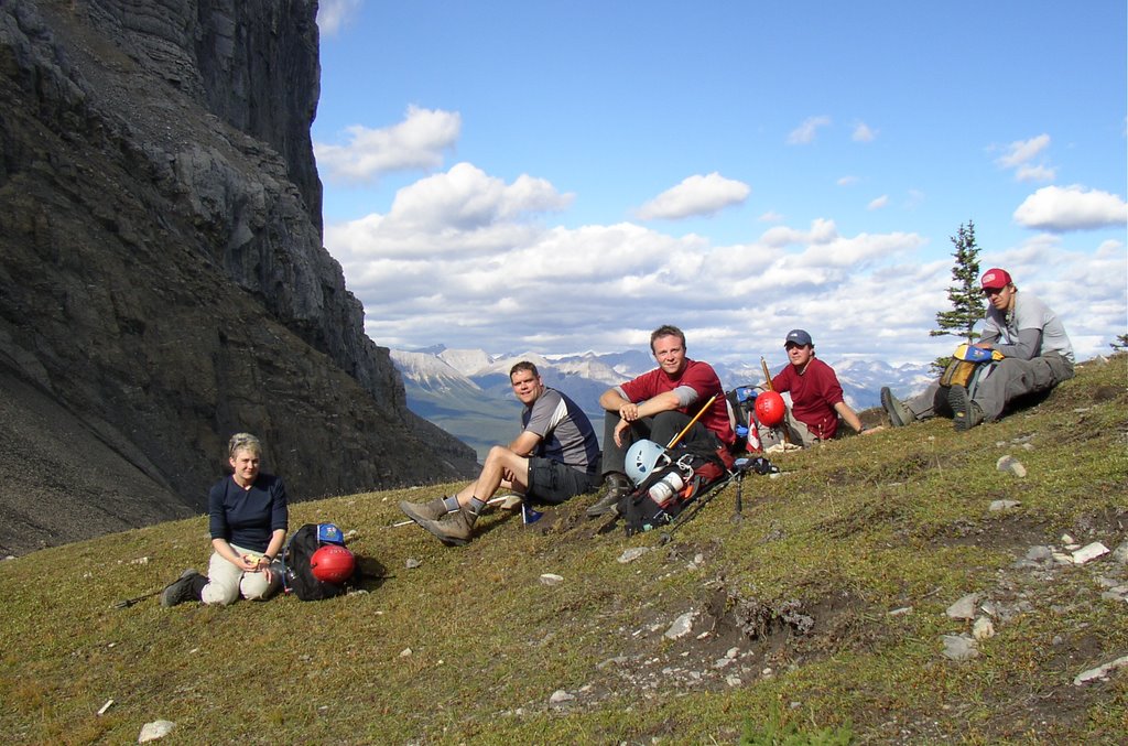
Our group takes a break at the saddle.

Marc negotiating typical terrain on Roche Miette.
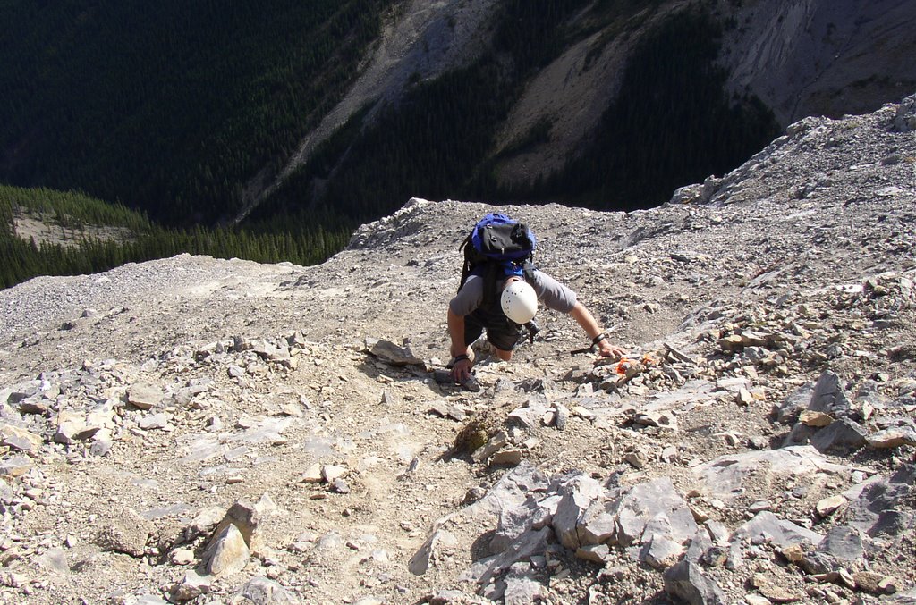
Trevor getting within striking distance of the summit plateau. This is such a hero shot.
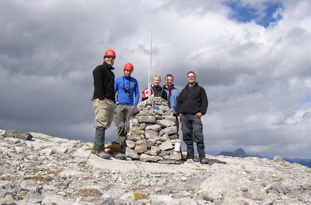
At the cairn. The true summit of this mountain is a leisurely 600m walk to the south from the point where you get onto the plateau, it is not at the top of the cliffs guarding the north face. The reason why is apparent when the mountain is viewed from the west, it's the highest spot from that vantage.
posted by Troy at 10:52 AM
0 comments
![]()